Being Neighbourly captures the icons and lesser-known sights of Hong Kong Island's most densely populated district.
Author/
Being Neighbourly
Share
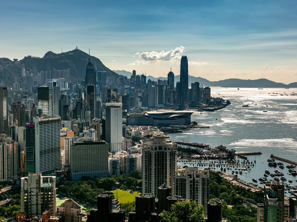
View towards Central. Credit: Peter Sung.
Eastern District is not only Hong Kong Island’s most densely populated district, it is the second-most populated district of all the territory’s 18 districts. Its residents have the third-highest median income. Though many of its neighbourhoods may be unknown (other than to those who live there), Eastern is, today, synonymous with connectivity: both the Island Eastern Corridor and the Eastern Harbour Crossing are located there. From Sai Wan Ho to Chai Wan are mostly Home Ownership Scheme and public housing estates, while the district is also the location of large private housing estates including Tai Koo Shing, Kornhill and Heng Fa Chuen. Though mostly residential, Eastern is the location of the business district of Quarry Bay and home to malls such as City Plaza.
Land Area 18.9 km2
Population* 588,094 *2011 figures
Biggest Neighbourhood
Shau Kei Wan
Fortress Hill
As one might guess, Fortress Hill is a hill. It is situated on the north shore of Hong Kong Island and encompasses the western part of North Point, west of Oil Street, and the eastern part of Causeway Bay. Like many neighbourhoods, it is an amalgamation of private residential estates, office buildings, hotels and serviced apartments. The names of Oil Street and Shell Street come from the former oil depot of Royal Dutch (now Royal Dutch Shell) in and date from 1897. The depot itself was decommissioned in 1981.
North Point
The name ‘North Point’ was first used by a British lieutenant Collinson (1821–1902) in a 1845 map to mark the northernmost point of Hong Kong Island. However, areas in and around North Point have been inhabited since before the British arrived. However, given the area’s hilly aspect, North Point was slower to develop during the early colonisation of Hong Kong, than Central and Sheung Wan. That said, by the end of 1960, North Point was listed as the most densely populated place on earth by the Guinness Book of Records. The North Point Refugee Camp was built to accommodate refugees from the Mainland, and later, during World War II, renamed the North Point Camp, housing captured Canadian soldiers during the Japanese occupation. During the Sino-Japanese War, and the Chinese Civil War, a large number of the rich and middle class from Shanghai fled to Hong Kong and settled in North Point, giving its moniker “Little Shanghai”. Later, the influx of Hokkien Fujianese in the late 1960s gave North Point, a new moniker, “Little Fujian”.
Braemar Hill
Braemar Hill is a hill of 200m, which is popular with hikers. The name of the hill is said to derive from the Scottish village of Braemar bestowed by British colonial powers. Today, the north and western sides of the hill boast upmarket real estate and Braemar Hill is considered to be an affluent affluent area with convenient access to a large number of schools.
Quarry Bay
Quarry Bay is a residential and business district. One Island East, the seventh tallest building in Hong Kong, is located there and several government departments and multinationals have relocated their offices there. Quarry Bay has a dense population and given its work hub status, it is, not surprisingly, a transportation hub. There are two MTR stations in the district, Quarry Bay Station and Taikoo and the area is conveniently linked by bus and tram. In previous years, the area was but a bay where rock from the hillsides were quarried and transported by ship for the construction of buildings and roads.
Tai Koo Shing
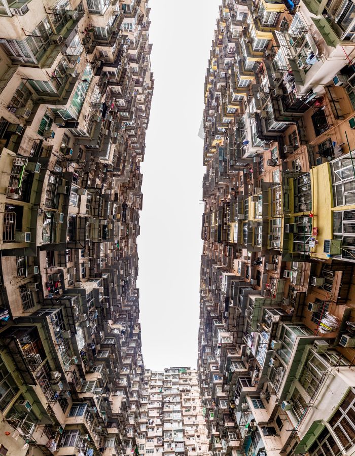
‘Taikoo’ is the Cantonese pronunciation of Swire’s Chinese name, while’ Shing’ means City. The entire Taikoo Shing estate covers 21.5 hectares and consists of 61 residential towers, with a total of 12,690 apartment flats that ranges anywhere between 489 sq ft to 1,114 sq ft. The Taikoo Shing estate was once the site of the Taikoo Dockyard, whose foundation stone now lies beside Cityplaza. Swire Properties was established in 1972 immediately after the closing of the dockyard with constructions of all main residential buildings completed by the early 1990s. The estate is also a very sought-after place to live for Japanese and Korean expatriates. Because of this, the area has many Korean and Japanese-themed eateries.
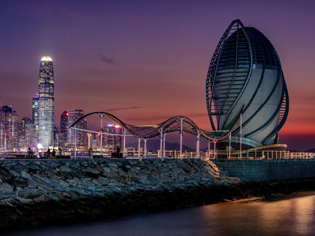
Credit: Peter Sung.
Sai Wan Ho
Sai Wan Ho extends between Taikoo Shing Road, Shau Kei Wan Road and King’s Road junction to the west, and the Shau Kei Wan tram depot in the east. It is bounded by the Victoria Harbour to the north, and mountains to the south. This primarily residential area between Quarry Bay and Shau Kei Wan features the Sai Wan Ho Ferry Pier, with routes between Sai Wan Ho and Kwun Tong and Yau Tong.
Shau Kei Wan
Shau Kei Wan is a densely populated residential district. ‘Shau Kei’ is the Chinese word for a basket used to wash rice, like a colander, and Wan means ‘bay’. The name refers to the former shape of the nearby bay, which is now named Aldrich Bay, after a British Army major. The area has gone through numerous changes, attracting local fishermen in the early 18th century as a good storm shelter, Hakka people from Huizhou who operated quarries and began building houses along the coastline. Most of the residents in the area lived in fishing boats at the time. By 1860, piracy had become a serious issue and Colonial Governor Richard Macdonnell (of Macdonnell Road) took measures to revitalise the area. Life for Shau Kei Wan as an industrial area began in the 1920s, when light industries began to move into the area. After World War II, Shau Kei Wan developed into a fish-trading market (a position it still holds today). In the 1960s, the Hong Kong Government began to replan the area, building public housing estates. After the fire of 1975, plans were speeded up. The government bulldozed slum areas and erected public housing in its place.
Heng Fa Chuen
Heng Fa Chuen is a private housing estate in Chai Wan, built on reclaimed land from Pak Sha Wan and Lei Yue Mun Bay. It was developed by MTR Corporation and Heng Fa Chuen Development with reclamation beginning in 1978, and enjoys a waterfront location with views of the Tathong Channel. Today’s promenade along the shore was once a beach.
Chai Wan
Chai Wan is located at the east end of Hong Kong Island next to Shau Kei Wan. It has a far-reaching history: The name ‘Chai’ means firewood, while ‘Wan’ means bay and it may be named due to the rich production of firewood. It is possible that there were inhabitants in Chai Wan during the Northern Song and Southern Song dynasties. Back then, merchants bought water in Chai Wan before they continued their journey to Guangzhou, Fujian province. In 1845, the British military built a fort and a barracks in Siu Sai Wan. In 1941, the Japanese invasion resulted in the Battle of Hong Kong, with around 20 gunners executed at the Sai Wan Battery despite having surrendered. In 1952, the government began building low-income housing that has replaced rural villages in the area. The area combines the industrial and residential and is built on land reclaimed from the bay. It extends west from Lei Yue Mun in Heng Fa Chuen and east to Siu Sai Wan. Shek O Country Park is at the south of Chai Wan.
Siu Sai Wan
Siu Sai Wan is a residential area in the northeastern part of Hong Kong Island in Hong Kong. It was originally an intelligence gathering centre for the UK to monitor wireless communications from Taiwan (ROC) to China (PRC), but these activities ceased in 1985. Around the same time, the development of the Mass Transit Railway, meant that residents in Chai Wan needed a new place to live and Siu Sai Wan was delegated as the place to accommodate them and the expanding population as a whole. Prior to reclamation, Siu Sai Wan was a small bay east of Chai Wan. While Chai Wan was once known as Sai Wan and the small bay as Siu Chai Wan or Chai Wan Tsai, over time the names combined into its current name of Siu Sai Wan.
Stay posted for our Eastern insider guides coming soon.
Peter Sung is a talented photographer who was born in Hong Kong. When he’s not in the territory, Sung is travelling for work in the Mainland and beyond. His stunning colour and black and white photographs have been recognized by National Geographic and in November 2024, he was awarded the recipient of the inaugural ‘Being Neighbourly Creativity Award 2024’.
Share
About the Author
Being Neighbourly
For over 20 years, the people behind BN have been creating content on the best things in life: food, travel and inspirational people.
Browse our Shop!
From books to posters, notebooks and pencils, we've got you sorted.